Trekking Vietnam’s Second-Highest Peak Pusilung

Conquering Pusilung in Lai Chau Province is a great challenge in both physical and mental endurance.
Next to the Chinese border, Muong The district of Pusilung is the second highest peak in Vietnam after the large Fansipan, known by the nickname of ‘Roof of Indochina,’ in Pa Ve Su Commune in the north-west province.

While the route has been closed for over a year due to the loss of some trekkers in China and the escalating situation at Covid-19, last November our seven party finally managed to obtain authority to challenge the top.
We were both half excited and half concerned about the news, even with a lot of trekking experience. After all, in Vietnam, the road to Pasilung is one of the worst, which takes more than 60 kilometers for three days. Just half of all trekkers were successful in statistical terms.

We set up our party in Muong Te Town, Lai Chau Province, onboard an overnight coach from Hanoi at 19:00. The next morning, after a short breakfast, we hired a car to drive us to Pa Ve Su Border Post, where we would make our final arrangements. While there is just 35 kilometers away from the town to the border, it took us nearly two hours because of bad roads.
We met our four Dao ethnic porters at the border post and discussed the delivery of luggage and travel. The porters had been traveling about 150 kilometers for five hours, from Lang Village, Phong Tho district, and meeting us there.
Following the finalization of protocol, we requested permission from the border guards to store some of our luggage at a kindly approved border post, clean clothes, and non-trekking gear. Then at 11 a.m., an hour later than expected, we continued our trek.
In the beginning, we crossed a wide stream across an improving bridge of thin iron ropes and bars that guaranteed us little protection. This will be the first of 11 streams on our itinerary.

The party entered the 2nd stream after an hour of trekking through a bush, where we had a short lunch break before heading for our cave campsite quickly.
We went past a curved mountain and entered the hut of an elderly couple from La Hu, who kindly gave us some cookery to cook.
It will be a long journey from this point to our last stop of the day. Since no trekker came here for more than a year, weeds and jungle wines have been on this path which has hindered our pace and even more energetic.
Here, with unpredictable wild creatures like snakes, wolves, and Leopards we had to keep a close eye on our porters and each other, as we reached the natural woods. We even walked by the weeds along a long hill, one mistake removed from the everlasting abyss.
While we were stressed, we decided to enter the cave as scheduled, or otherwise, we would have to walk for more than 15 hours to the top and back to camp in the sick weather.
After walking in the dark for two hours, we entered the cave, 2,600 meters above sea level at 7 p.m. While it tried, we were really happy with our decision.
Before taking a bath we quickly set up camp in a little stream close by, as well as the porters made a complete, nutritious meal like banh chung, traditional Vietnamese sticky rice cake with pork and mung beans, and a selection of canned beef, pork and chicken.
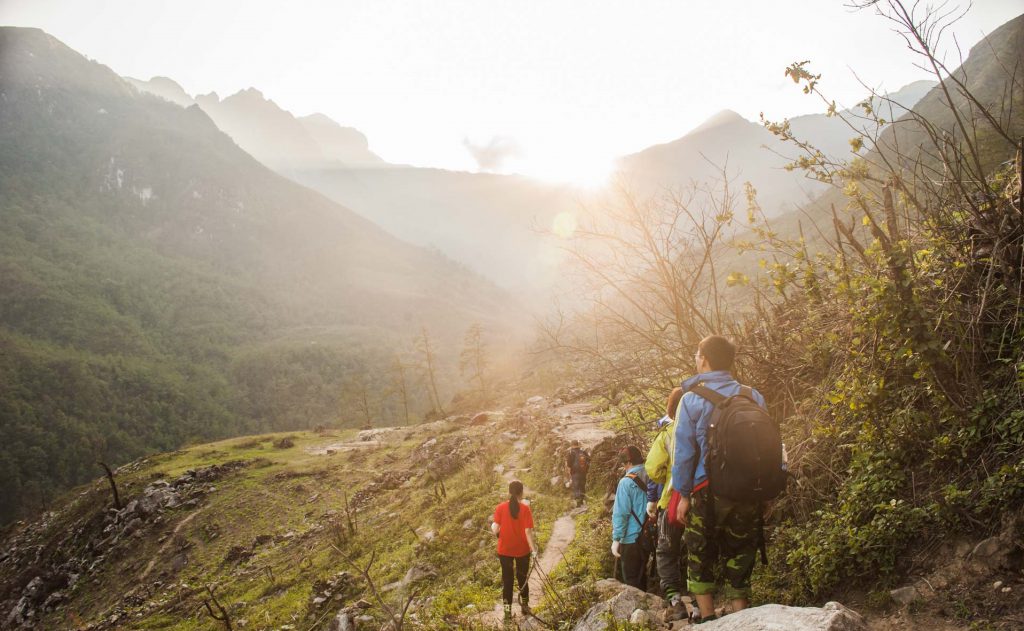
We began our trip with flashlights before 6 a.m. on the second day. While the temperatures were incredibly low, we all had to cut an outside layer after 20 minutes, as the sun was shining over the treetops.
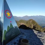
We reached the Border Mile 42, constructed in 2008 and the second-highest one in Vietnam at 2,866 meters after a four-hour trek, passing through bamboo, beech, and oak woods.
We have taken a short break, took a few pictures, and returned quickly to our trek. From then on, Tan Chinh Khe, our porter, said it is really convenient to get lost and go across the national border with China and remain close together.
The toughest part of the trip is crossing broad, fluctuating pistes from the boundary milestone to the summit. This section of the journey, which was only stopping on the 42nm Border Milestones, was therefore agreed by a lot of people to miss the way, according to Nguyen Hoang Bac of the Lim Traveling Corp. The best time to hit the boundary landmark is one morning.
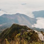
This difficult part of our tour was nonetheless the most enriching and picturesque ancient woodland. Rhododendron, denser and better than everywhere else in the area is the most identifiable tree. As we traveled in November, the trees changed their leaves and created a still mystifying landscape.
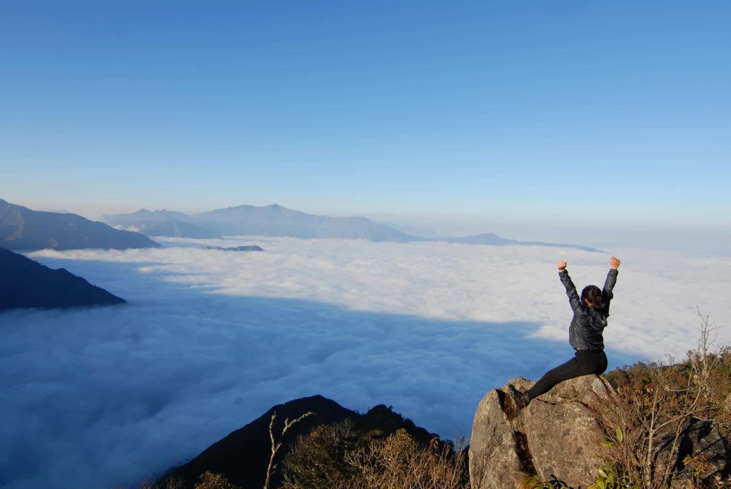
At mid-noon, as expected, the party eventually hit the peak. Though physically and mentally carefully trained, we were very enthusiastic here. However, Pusilung was entirely different in its great happiness, recognizing that we had completed one of the most difficult excursions in the area.
We had lunch before going down to 1 p.m. Take some photos. We stopped once every 15 to 20 minutes because of the difficult terrain in order to avoid the build-up of sweat from which colds could be caught. At 6:30 p.m., we entered the base.
The party stayed in the mountain cave the second night before going down the third day at 5 a.m. We finished our triple-day discovery of the glorious Pusilung at the border post at mid-noon.
Conquering Pusilung is the most difficult journey we have ever experienced physically and emotionally. We would not have been able to finish without the solid efforts of the party and the great support of the border guards and the porters, apart from good preparations and good weather.